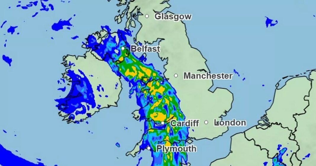
Britain is set to be hit by a 250-mile stretch of rain today – with only a few parts of the country escaping the downpours.
Weather maps from the Met Office show rain moving east to cover a large area stretching from Dover to Caernarfon in North Wales this morning, including London, Manchester and Birmingham. Patches of wet weather will also reach parts of Northern Ireland and Scotland, though the main section of this weather front is expected to clear from around 9am, leaving most areas dry by lunchtime. Smaller isolated showers will then scatter across mainland Britain throughout the rest of the day, though some areas to the north, including Cumbria and the central belt of Scotland, are set to stay completely dry on Wednesday.
In a forecast last night, Met Office meteorologist Clare Nasir said that the wet weather was “all courtesy of an area of low pressure which will slide down across England and Wales tomorrow, just bumping in towards the far south west of Scotland.”
She added: “Into Thursday, more clouds across the northeast of Scotland – and then we look towards the west where there will be a succession of weather fronts moving in erratically into Friday.”
A total of 18 Environment Agency flood alerts remained in place overnight following heavy rain over recent days.
This included the River Dart in South Devon, where local people were warned of “flooding to low lying land and roads” late on Tuesday.
River levels are expected to “remain high” this morning, with levels on Rivers Avon, Erme and Harbourne, and coastal streams from Bigbury to Dartmouth also being monitored by officials.
Despite the damp feel to the weather of late, one forecaster believes a return to summer-like temperatures is coming next week – with the hottest day of the year so far potentially on its way.
James Madden from Exacta Weather said: “From later this week, we will see high pressure exerting its influence on some much warmer weather across our shores during late April and early May over several days at the very least.
“Additionally, and despite current app projections from elsewhere for this period for significantly lower temperatures than what will occur in reality, parts of the south could easily see top temperatures ranging in the mid to high 20s at times in this period and even parts much further north could see temperature values approaching or slightly exceeding the mid 20s in the best of the sunshine.”
Early rain will clear southeast England, then most places should be dry with bright or sunny spells. A few showers developing in the afternoon. Feeling warm in the sunnier breaks.
Mostly dry on Thursday, with sunny spells. Rain likely across northwestern parts of the UK on Friday, slowly easing on Saturday. Mainly dry elsewhere, with warm spells of sunshine.
At Reach and across our entities we and our partners use information collected through cookies and other identifiers from your device to improve experience on our site, analyse how it is used and to show personalised advertising. You can opt out of the sale or sharing of your data, at any time clicking the “Do Not Sell or Share my Data” button at the bottom of the webpage. Please note that your preferences are browser specific. Use of our website and any of our services represents your acceptance of the use of cookies and consent to the practices described in our Privacy Notice and Cookie Notice.


