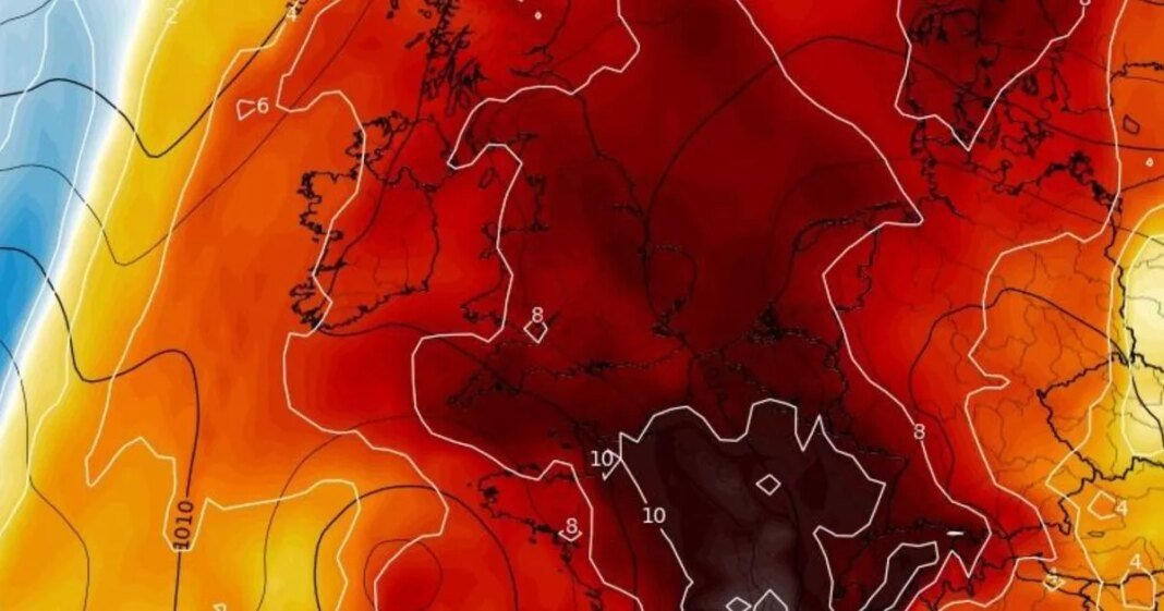
Temperatures are set to soar by the tail end of this week, but April’s sunny fortunes could come crashing down with brutal wind and rain as soon as this weekend.
According to the Met Office, the forecast is expected to peak at 23C today (April 10) and on Friday, with people living in the south-east of the country expected to bask in the highs thanks to a “change of wind”. The higher-than-average temperatures have reached as far north as Northern Ireland and Scotland, both of which have recorded their highest thermometer readings so far this year.
But, despite the first 11 days of April showing nothing but a glorious start to spring, wind and rain has now been forecast by the Met Office. Chief meteorologist Andy Page said: “Warm and dry weather continues for much of the UK this week, but we’ll see a shift in where the highest temperatures will be over the next few days.
“Those living along North Sea coasts, who have so far had generally lower temperatures and more cloud at times, will start to see the higher temperatures on Thursday, possibly reaching as high as 23C in eastern Scotland and northeast England. This is due to a shift in the dominant wind direction from the east to the west.”
The north-west of Scotland will be the first to see “drizzle” later in the day on Friday into Saturday, marking what the Met Office describes as the “gradual transition” to more unsettled weather.
Met Office deputy chief meteorologist Mark Sidaway added: “The high pressure that has been responsible for our recent high temperatures gradually shifts away over the weekend, as more of an unsettled regime begins to take charge and introduces more frequent rain and cloud, as well as a drop in temperatures.
“Those in the far northwest will see the first of the rain late on Friday and into Saturday, and while Saturday will start dry for much of the UK, we are likely to see areas of showers moving in from the south later in the day, although this aspect is still quite uncertain. However, by Sunday fresher conditions with showers are expected to move in from the west.”
Low pressure is likely to lie west of the UK into next week with showers and some longer spells of rain likely, but also some drier and sunnier intervals, with temperatures around average for the time of year
Weather maps show a very slow tumbling of temperatures from Monday, with the south-east, including central London retaining a mercury of around 14C. But by Tuesday, April 15, another five degrees comes away, with top temperatures of 10C.
While a volatile period takes hold, much of the Midlands manages to keep hold of highs of 15C to 16C by the middle of next week, but the trade-off is the deluge of rain that is expected to blanket much of the country overnight on Tuesday and into Wednesday, with the situation worsening across the southern coast by Thursday and into next Friday.
Current GFS weather maps show parts of southern Britain could be lashed by 60mm of rain by Friday, April 18, but this is expected to change as confidence grows early next week.
At Reach and across our entities we and our partners use information collected through cookies and other identifiers from your device to improve experience on our site, analyse how it is used and to show personalised advertising. You can opt out of the sale or sharing of your data, at any time clicking the “Do Not Sell or Share my Data” button at the bottom of the webpage. Please note that your preferences are browser specific. Use of our website and any of our services represents your acceptance of the use of cookies and consent to the practices described in our Privacy Notice and Cookie Notice.


