
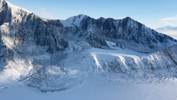

A team of researchers from the Yukon Geological Survey is currently conducting aerial surveys in a remote mountainous area in southwest Yukon to investigate avalanches and landslides triggered by a magnitude 7.0 earthquake that hit the region last month.
The earthquake, which occurred near the Alaska-Yukon border on December 6, has provided geologists with evidence of a previously unknown fault beneath the earth’s surface, confirming a long-standing hypothesis. According to Michael West, Alaska’s state seismologist and research professor at the Alaska Earthquake Center, the region where the earthquake struck has been relatively unexplored due to the convergence of two major plate boundary systems.
Describing the area as a unique intersection of massive plate boundary systems, West highlighted the lack of comprehensive understanding regarding its geological dynamics, often referred to as the ‘train wreck of plate tectonics’.
While both Alaska and the Yukon are known for their seismic activity, the recent earthquake occurred in an area with minimal historical earthquake occurrences. The event has drawn international interest as it validates theories linking the North American plate boundary with significant faults within the plate, a concept proposed since the 1960s.
The earthquake, which was felt most intensely in the communities of Burwash Landing and Haines Junction, Yukon, also had repercussions in Whitehorse, located approximately 250 kilometers away. Residents, such as Pascale Dubois from Burwash Landing, recounted their experiences of intense shaking and fear of structural collapse during the seismic event.
Despite the earthquake’s magnitude, its impact on Yukon residents was relatively minor, underscoring the region’s resilience. According to West, a magnitude 7 earthquake of that scale could have catastrophic consequences in other parts of the world.
The aftermath of the earthquake is visibly evident in the rugged terrain of Yukon’s Kluane National Park, where researchers are conducting field reconnaissance to study the fault and its seismic effects. The ongoing research aims to enhance understanding of deformation processes and mountain-building activities in the region.
The earthquake and its ongoing aftershocks are anticipated to yield valuable insights into the region’s seismic activity, potentially leading to the identification of new fault lines. By mapping the underground fault systems, researchers hope to mitigate earthquake risks and enhance preparedness for nearby communities.